Great Canal plays crucial role in Ming-Qing era
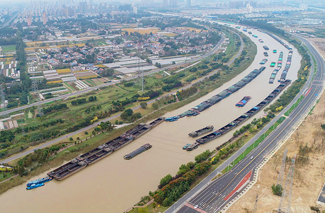
Barges navigate a section of the Grand Canal in Huaian City, Jiangsu Province. Photo: CHINA DAILY
In early July 1599, the Italian Jesuit missionary Matteo Ricci traveled to Beijing from Nanjing via the Grand Canal waterway. He had a keen eye for canal installations, transportation, and natural and social customs along the way. While marveling at what he had seen, he also mentioned some of the difficulties in canal transportation in China, and the limitations of the Ming court’s vision as an inland empire.
In fact, the background, functions and effects of the Grand Canal are much more complex. Longitudinally, the construction and use of canals is part of the tradition of water control in Chinese civilization. The Beijing-Hangzhou Grand Canal was inherited from the Sui and Tang dynasties, and it did not disappear completely with the emergence of new transportation facilities and tools in modern times. Horizontally, the Grand Canal connects the most important eastern region of China and flows through a number of large and small regions with different natural and social conditions. Together, these regions have nurtured the longest and oldest canal in world history.
Vast waterway system
The construction and use of artificial waterways has a long history in China. Constructed in sections from the 5th century BC onwards, the Grand Canal was conceived as a unified means of communication for the first time in the Sui Dynasty, was reconstructed north-south straight from Beijing to Hangzhou in the Yuan Dynasty, and then peaked during much of the Ming and Qing dynasties. The key infrastructure of the Grand Canal was indeed completed in the early Ming Dynasty, thereafter contributing greatly to the economic prosperity and stability of the Ming and Qing dynasties.
There was a North-South difference in the construction and maintenance of the Grand Canal infrastructure in the Ming and Qing dynasties. In the north, the natural conditions of high terrain, cold and dry climate, and lack of water were the biggest challenges for large-scale artificial transport routes. To deal with the problem, in the Ming Dynasty, reserviors were built to cope with the threat of drought and flooding in Shandong Province. The Qingkou water-diversion complex, which is the meeting point of the Yellow River, the Huai River and the Grand Canal, is an engineering masterpiece that provided a solution for the Grand Canal to join the Huai River to cross the Yellow River.
The abundant water resources in the South led to the long-term development of natural water transportation systems. During the Ming and Qing dynasties, the Jiangnan Canal, as an important section of the Grand Canal south of the Yangtze River, was composed of sections of artificial waterway and natural waterway. It intersected with the Taihu river system along the way and became a backbone of the Jiangnan water network.
In order to maintain the operation of these inland waterways, facilities and transport vessels, the Ming and Qing courts invested endless material, human and financial resources, and in doing so, they took advantage of the huge and complicated bureaucratic system of the whole country. Local governments at all levels along the canal corridor had commissioners to take charge of canal affairs, while the central government expressly set up special management agencies.
Most historical documents from the Yuan, Ming and Qing dynasties, including all kinds of waterway maps, regard the Beijing-Hangzhou line as the Grand Canal, but it cannot be regarded as independent from the other man-made and natural waterways connected with it. During the Ming and Qing dynasties, the transport routes of eastern Zhejiang declined, but the waterway from west to east of the Ningbo-Shaoxing plain could still serve as an extension of the Grand Canal and thus connect the maritime Silk Road.
Geographic division of labor
The Grand Canal ran through the most developed area in China during the Ming and Qing dynasties. It reshaped the natural and social structures of various regions along the route, gave rise to different economic, social and cultural patterns, and promoted interaction and communication among regions.
It is generally believed that from the Qin Dynasty, the Yellow River basin of northern China was a typical agricultural civilization. Since the Yuan Dynasty rebuilt the Grand Canal, the commercial economy along the canal in the north began to boom due to transportation and trade. After the reconstruction of the Grand Canal in the early Ming Dynasty, it entered a golden age of grain transport that continued until the middle of the 19th century.
As commercialization, commodity economy and urbanization relied heavily on transportation, the north was a typical example of an “external-driven” development model.
In contrast, the middle and lower reaches of the Yangtze were characterized by a market mechanism. Since the Song Dynasty, this area has steadily become one of China’s economically advanced centers.
During the Ming and Qing dynasties, the commodity production and circulation in the Jiangnan area matured, forming a hierarchical regional market system. Local markets in the Taihu plain were booming and the central urban markets of the “Jiangnan economic zone” transcended natural and administrative barriers, as seen in Suzhou and Hangzhou. This commercialization and urbanization was based on the commercialization of local agricultural production, which can be called an “endogenous” socioeconomic development model.
Through the canals and natural waterways, Jiangnan had unprecedented trade and economic links with the rest of the country, as well as with overseas markets. It can be said that the improvement and enhancement of transportation conditions promoted the professional division of labor in nationwide production. Jiangnan’s market radiated into the national market in a multi-directional, multi-level and multi-channel manner effectively promoting the marketization of national economic life, which in turn strengthened the specialization of production and the regional division of labor.
Great unity
The Qin Dynasty was the first unified, multi-national and power-centralized state in Chinese history. For ages, Chinese rulers have been deliberating on how to maintain a unified empire. From the Sui Dynasty to the Ming and Qing dynasties, one of the major national policies was to rely on the Grand Canal to play a powerful role in facilitating the economy and delivering government orders.
First, from the end of the Han Dynasty, the economic center of the Chinese mainland gradually shifted south to the middle and lower reaches of the Yangtze River, resulting in the political split between the north and the south. During the Sui and Tang dynasties, the great unified empire was rebuilt to solve the problem of geographical separation between the political center and the economic center by shipping grain collected from the south to the capital and the frontier fortress through the Grand Canal.
During the Ming and Qing dynasties, grain was mainly collected from the middle and lower reaches of the Yangtze River, known as “southern grain,” while “white grain” was collected from the core regions of Jiangnan, which conventionally was called the “heavy taxation of Jiangnan.” In comparison, “northern grain,” collected from Shandong and Henan provinces, was small in quantity, though the hard physical labor it required was heavier.
With the development of transportation and trade, taxes were of great importance in national revenue. In the Ming Dynasty, seven of the eight Customs Houses were located along the Grand Canal. The control and governance of the richest areas such as Jiangnan was top priority for Ming-Qing rulers, which is also how the consolidation of the entire nation was achieved.
The advantage of the unified state was to mobilize all kinds of human and material resources, at any cost, to construct and sustain such a major public undertaking. The developed water and land transportation system effectively carried out the will of the imperial court across the nation. Information communication and cultural exchanges enhanced regional connectivity.
The central government redistributed the collected products and wealth based on the will of the state, so that the rural and border areas could maintain a minimum level of living, a crucial factor in safeguarding national stability.
The overall interests of the country are higher than the local interests. To satisfy this goal, the government first focused on supporting important strategic regions. During the Ming and Qing dynasties, some cities and towns along the Grand Canal, such as Tianjin, Jining, Linqing and their neighboring areas, became beneficiaries of national policies, and consequently commerce and cities developed.
Moreover, the comprehensive water conservancy projects involving the Grand Canal and the Yellow River also improved local natural conditions and improved flood control and irrigation functions. The beneficiaries also took on heavier responsibilities, such as hard physical labor in the north and heavy taxation in the south of the Yangtze River, though the economic and living standards were still higher.
Inevitably, some local areas were sacrificed, such as southwest Shandong, eastern Henan, and northern Jiangsu, which became the hinterlands of the Grand Canal as a heavy price for being marginalized. They provided manpower and material resources for the maintenance of the Grand Canal infrastructure and the operation of the water transport, but they did not get the compensation they deserved and suffered serious consequences caused by the sharp deterioration of the natural environment.
The Grand Canal, which runs from north to south through the east-west rivers in eastern China, has greatly changed the existing hydrological and geological structures. In the long run, sacrificing the environment to nourish the population led to environmental deterioration and natural disasters. To be fair, due to the technical level of the pre-industrial era, the government’s efforts to transform the environment also had their limits.
Since the middle of the 19th century, China has been in the midst of internal and external troubles, and the Grand Canal facilities and the canal transportation system have also been deeply affected, declining and ending in an environmental crisis caused by man.
In modern times, China has undergone unprecedented changes in its political, economic and cultural development from the coastal areas inland. The canal area in the north gradually declined, and the scene in the south was complicated. The Jiangnan region has gone through a relatively successful transformation in the new context of maritime civilization.
Sun Jinghao is a professor from the School of Humanities at Zhejiang University.
edited by YANG XUE